Master Index Nearest Caches Le Minou by bob29 (1,5/1,5)
N48° 20.333 W4° 36.827 (WGS84) UTM 30U E 380411 N 5355225 Use waypoint: GC10X0C Size:  Small Hidden on 11-02-2007 Small Hidden on 11-02-2007
In Finistère Bretagne, France Difficulty:  Terrain: Terrain: 
*No attributes specified* Add cache to watch list Log your visit Picture Gallery |
| Beau comme un phare dans la tourmente. Beautiful like a headlight in the storm. |

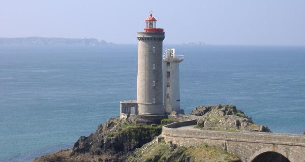
Le phare du Minou
WP1 : Stationnez votre véhicule à : 48° 20.333N – 04°36.827W, le parking n'est pas grand mais il y a de la place pour une vingtaine de voitures.
WP2 : Dirigez vous maintenant vers la porte d'accès du fort et examiner le panneau descriptif des lieux situé en : 48° 20.317N – 04°36.844W. C'est lui qui va vous aider à trouver le waypoint final. J'ai été obligé de le placer à environ 300 mètres de là car l'endroit est très fréquenté notamment lors de la saison estivale.
WP3 et dernier la cache : 48°20.UVW Nord – 04°36.XYZ Ouest. Déduisez 1169 de la date de construction du fort et vous obtenez UVW. Considérez l'année où l'on a vu aboutir l'un des tout premiers câbles télégraphiques transatlantiques assurant la liaison avec les états unis comme A.B.C.D (par exemple 1205 = A=1 B=2 C=0 et D=5) et servez vous de ce code pour déterminer que X= A+C, que Y= A+B et que Z= D. Au pied d'un arbre au bord du chemin.
Un grand merci à Janpe pour la bonne traduction en Anglais.
WP1 Park your car at N48 20.333,
W004 36.827, the car park is not large but there is room for about
20 cars.
WP2 Go to the entrance door of the fort and look at the
information board at N48 20.317, W004 36.844. This has the
information you require to find the cache. The cache is about 300
meters away because the area is very busy at holiday times.
WP3 (Cache) N48 20.UVW W004 36.XYZ
Take 1169 from the date of the construction of the fort to give
UVW.
Letter the numbers of the date of the year of the first successful
Transatlantic Telegraph cable connecting with the United States to
give ABCD (for example 1205 - A=1, B=2, C=0 and D=5) Use these to
calculate X,Y and Z where X=A+C, Y=A+B and Z=D
At the base of a tree on the side of the path.
Thank you "Janpe" for the good translation in English.
Additional Waypoints
P210X0C - Point2N 48° 20.317 W 004° 36.844
Panneau descriptif des lieux
P310X0C - Point3
N/S __ ° __ . ___ W/E ___ ° __ . ___
La cache
Additional Waypoints (1)
| Code | Name | Type | Links | Comments | Date | Coordinates | Distance |
| P210X0C | Point2 | Stages of a Multicache | Google Maps | Panneau descriptif des lieux | 11-02-2007 | N 48° 20.317 W 4° 36.844 | 0,04 kms SW |
Current at 24-06-2010
![]() 16-06-2010 by saverne54
16-06-2010 by saverne54
Après une petite pose sous les pins maritimes, la boite est vite trouvée et il ne reste plus qu’à descendre le sentier pour tomber sur la voiture. Merci pour la cache.
In : Donald
![]() 03-06-2010 by Team MiTiKa
03-06-2010 by Team MiTiKa
#16 during our holiday in Brittany
The fourth one on today's tour from Porsmilin to Le Fort Minou on GR 34
We tried to solve the riddle at home - and failed. At least for foreigners it's necessary to come to the spot to get the numbers straight - and that's exactly as it should be.
The Fort Minou was the turning point of today's tour.
The cache wasn't too difficult to find, and after logging, we started to make our way back home.
TFTC
Team MiTiKa & Samba
![]() 29-05-2010 by famille-le-couls-29
29-05-2010 by famille-le-couls-29
Merci pour cette cache à grand spectacle grâce au coup de vent sur la mer d'Iroise...
IN: étoile en bois et encore deux petits trucs dont je me rappelle plus!...
OUT: une sorte de "U" en métal doré, et encore deux petits trucs dont je ne souviens plus!...mais promis, on suit la règle minimum du un pour un!
![]() 17-03-2010 by vince29
17-03-2010 by vince29
Jolie balade sous le soleil. Bonne petite marche. Pris : bouteille vache, Mis: un billet de Singapour.
![]() 25-02-2010 by TYGWEN
25-02-2010 by TYGWEN
belle enigme avec visite du fort quel spectacle.
in scouter
out gallet papillon
Nearby Caches
GC20XZ6 Pins maritimes (0,56 kms E)
GC14Y7G Le cinquieme hauban (0,80 kms NW)
GC14JZ1 Bruyères et ajoncs (2,45 kms NE)
GC24HJX Entre le fort, la bruyere et les ajoncs: (2,60 kms NE)
GC241QE Le châtaignier de la ribine. (2,80 kms NE)
Hints (Back)
Fr:Pas très loin de là, au pied d'un arbre, Dans un petit chemin.
Eng: Not far away, at the base of a tree, on a small path.
